Back to project map
Khaos Research · Data Science & AIPublished in Springer Nature Journal of Big Data (DOI: 10.1186/s40537-023-00770-z)

LandCoverPy: Distributed Satellite Pipeline

Scalable distributed workflow for high-resolution land cover and land use classification across large geographic areas (Mediterranean Basin). Orchestrates Sentinel-2 satellite granule ingestion with Dask, atomic MongoDB coordination locks, and MinIO/S3 lifecycle management, reducing data processing overhead by 80%.

PythonDaskSentinel-2MongoDBDockerMinIOGeoTIFFRasterio
80%Processing SpeedupDask Tile & Season Sharding
540+ TilesGeographic ScaleMediterranean Basin (Spain & Portugal)
10 mSpatial ResolutionSentinel-2 L2A MSI & ASTER GDEM
CASE STUDY / LANDCOVERPY

Scaling Earth Observation & Machine Learning Pipelines

01
The Challenge

Problem Statement

Classifying multi-temporal land cover over extensive geographic areas such as the Mediterranean Basin requires processing hundreds of Sentinel-2 granule tiles across four seasons. The sheer volume of raw multi-band raster data (terabytes) easily causes network bottlenecks, disk exhaustion, race conditions between workers, and days of computing overhead.
02
The Solution

Architectural Approach

Designed a divide-and-conquer distributed architecture decoupling compute workers from storage. Workers coordinate dynamically via an atomic tile_claims collection in MongoDB with TTL-based crash recovery, download granules on demand, compute 11 multi-spectral and biophysical composite bands (NDVI, NDWI, SAVI, BSI), and stream intermediate products into MinIO/S3 object storage with automated chunked purge lifecycles.

03
My Contribution

Core Impact & Implementation

Engineered the Dask distributed pipeline and parallel tile/season execution flow, achieving an 80% speedup in end-to-end dataset generation. Implemented distributed synchronization locks preventing duplicate tile downloads, and containerized the end-to-end pipeline with Docker Compose for reproducible execution across heterogeneous compute nodes.

04
Next Evolution

Roadmap & Future Scaling

Published in Springer Nature Journal of Big Data (DOI: 10.1186/s40537-023-00770-z). Serves as an institutional foundation for automated land use classification and agricultural monitoring models in European research programs.

Media & Demonstration Gallery

Visual Artifacts & Working Prototypes

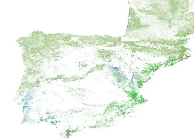
LandCoverPy Iberian Peninsula Forest Classification Map Enlarge
LandCoverPy — High-Resolution Land Cover Classification Map

High-resolution classification map generated from multi-temporal Sentinel-2 composites and DEM data over the Iberian Peninsula.